JOIN OUR WHATSAPP GROUP. CLICK HERE
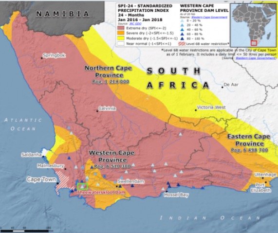
Map of South Africa that indicates the drought-stricken areas
Map of South Africa that indicates the drought-stricken areas a map of South Africa showing the areas affected by the drought The South African regions with severe water shortages are shown on the map below. The Western Cape Province, Easter Cape Province, and Eastern Cape are the provinces most badly afflicted by the draught.
The University of Cape Town asserts that inter-annual variability in rainfall and the severity of the current drought are not the only causes of South Africa’s water shortages.
The below map Map of South Africa indicates the drought-stricken areas as of 2018

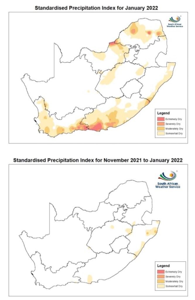
The drought-stricken areas as of 2022

Different types of Droughts in South Africa
Discussion on the different types of droughts in South Africa: Droughts are categorised into four major categories namely:
- agricultural,
- meteorological,
- hydrological and,
- socio-economic drought
How to Pass Geography Grade 11 with distinctions
One of the most significant accomplishments in your academic career is passing matric. It provides access to a wide range of post secondary options and employment possibilities. Use our best study advice to complete your matriculation, and you’ll succeed with flying colors.
- Attend class
- Ask questions
- Make notes
- Study
- Practise
- Study groups
- Extra class
- Motivation
- Complete assessments
- Prepare for the Exams in due time
Download Past Exam Papers & Memo per Province
- Department of Basic Education Grade 9 Exams
- Eastern Cape Papers and Memorandum
- Free State Papers and Memorandum
- Gauteng Papers and Memorandum
- KwaZulu-Natal Papers and Memorandum
- Limpopo Papers and Memorandum
- Mpumalanga Papers and Memorandum
- Northern Cape Papers and Memorandum
- North West Papers and Memorandum
- Western Cape Papers and Memorandum
JOIN OUR TELEGRAM CHANNEL. CLICK HERE

Be the first to comment