JOIN OUR WHATSAPP GROUP. CLICK HERE
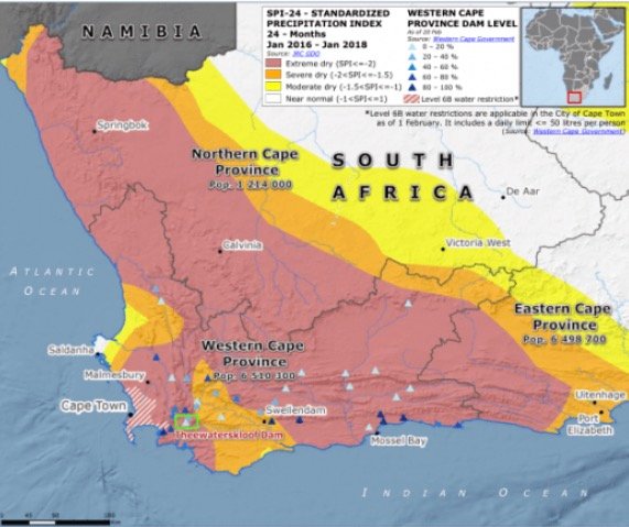
Map of South Africa that indicates the drought-stricken areas
Map of South Africa that indicates the drought-stricken areas Drought-affected areas are highlighted on a map of South Africa: The map below depicts the locations of South Africa where draught has resulted in severe water scarcity. The provinces most badly affected by the draught are Western Cape Province, Easter Cape Province, and Eastern Cape Province.
According to the University of Cape Town, drought intensity and inter-annual variability in rainfall are not the sole causes of South Africa’s water challenges.
The below map Map of South Africa indicates the drought-stricken areas as of 2018

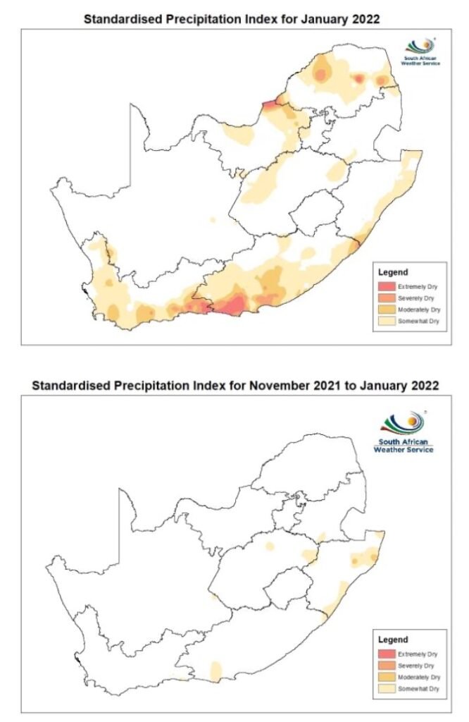
The drought-stricken areas as of 2022

Different types of Droughts in South Africa
Discussion on the different types of droughts in South Africa: Droughts are categorised into four major categories namely:
- agricultural,
- meteorological,
- hydrological and,
- socio-economic drought
JOIN OUR TELEGRAM CHANNEL. CLICK HERE

Be the first to comment